Past Onslow Street the river headed across Clerkenwell Road northwards towards Ray Street. Much confusion over the Fleet’s alignment arises because of the massive changes to the valley as a result of the building and presence of the Metropolitan/Circle lines in the area. Many people think the railway was built in the bed of the Fleet River, whilst others assume that the Fleet River’s course took it along Farringdon Lane and past the Clerk Well. I found the information on the area to the north of Farringdon Station a mass of confusion. An investigation of the situation was therefore neccessary.
The Fleet River never went that way…
For the first time you are going to read it here. This is another of those myths disbanded by London Canals! The Fleet NEVER went near the Clerk Well. The Fleet was NEVER obliterated by the building of the Metropolitan Railway at Farringdon in the 1860’s. The Metropolitan Railway’s route and the Fleet River’s route NEVER crossed at Farringdon! The Fleet River at ALL TIMES remained to the west of the Metropolitan railway’s route – and still does.
The Clerk’s Well is clearly documented as being on a tributary of the Fleet, so it has never been on or near the banks of the Fleet.

Ralph Agas’ map of 1560, showing the Fleet (blue) and Clarkes Well (circled red) some distance away.
Some of the confusion here seems to relate to an account of the building of the Metropolitan railway, which had me at times very puzzled as what what could be seen just didnt tally with what the railway account said. The source comes from a brochure, entitled ‘The Metropolitan Railway’ and this was published in 1865, two years after the railway was opened. It cites: “during the construction of the Underground line, the meandering stream of the Fleet ditch had to be crossed at least three times, before its cloacinal flood was diverted from its previous course.” The information can be found at ‘Underground London: Its railways, subways and sewers’, Old and New London: Volume 5 (1878), pp. 224-242. at British History online.
Three times?? Where are the ‘three crossings.’ The first discussed encounter by the railway is correct as stated here in that report of 1865: “Shortly before reaching King’s Cross, the great Fleet sewer crosses both the junction lines.” That refers to Kings Cross Bridge (the original 1863 Kings Cross station was at this location.) This tells us the Fleet passes across to the west side of the railway in its conduit towards Grays Inn Road.
Prior to the railway’s construction the Fleet actually flowed the other way along what is now Kings Cross Road. What follows is very misleading, for it says the railway “shortly afterwards passes under the Fleet ditch a second time, by a short piece of tunnelling.” This refers to Frederick Street. That is correct however with reference to the old river’s course as it flowed from Bagnigge Wells towards Mount Pleasant. But it is absolutely clear the author has it wrong for the river no longer flowed here. Next we are told the railway passes under the Fleet again at Clerkenwell Road (I take this reference to mean Vine Street bridge.) But the Fleet River never did go this way – never did – and still doesnt!
The three crossings in their correct context should be as follows: the first; In front of Kings Cross Station where the Fleet passed in a south east direction towards Grays Inn Road; the second is where the Fleet turns to the north east and passes through St Chad’s Well. This is approximately at what is now Kings Cross Bridge; the third is where the Fleet passed Frederick Street in a north east to south west direction. Beyond that the Fleet remained at all times on the west side of the railway’s route.
The Fleet River and its relationship to the Metropolitan Railway
Since the railway never touched the alignment of the Fleet River in the Farringdon area, there is no reason why the Metropolitan railway would have needed to divert the Fleet so far off its original (or its previously culverted course) towards the Clerk’s Well. In fact there isnt anything in the records to tell us that this was ever done. The Fleet was clearly culverted on a new alignment past Farringdon in order to accomodate the new drainage system required by the placing of the Metropolitan railway and the diversion/re-alignment/replacement of many of the roads in the locale. The Fleet’s burst into the railway works in 1862 is clearly somewhat due to a poorly constructed retaining wall and conduit on the west side of the railway.
The Fleet took a completely different course in relation to the route of the Metropolitan railway. This is consistent with what is shown on old maps (Roque’s map of 1746 and Greenwood’s map of the 1830’s) plus the river’s thalweg at St Cross Street and it’s alignment at the junction of Ray Street/Herbal Hill/Back Street Hill. The nearest the Fleet ever got to Farringdon Station is just to the east of the present junction between Farringdon Road and Cowcross Street. The location of the Clerk’s Well on the map below is indicated by a red circle, with the railway cutting clearly visible between this and Farringdon Road:

The Fleet’s former route from Warner St to Farringdon Road revealed by overlaying old & new mapping.
The Fleet River northwards from Farringdon
At Farringdon Lane (as shown above) the Fleet changed direction and headed north westwards across Farringdon Road south of Ray Street. One website says that the present bridge across the Metropolitan Railway is the site of the ‘old bridge’ across the river. This is absolutely incorrect and the result of bad research! Ray Street ran alongside the Fleet for a short distance but there was never a bridge. Ray Street was known as Rag Street in its early days, a reference to thievery.
Hockley in the Hole
Ray Street to its junction with Warner Street was once known as Hockley in the Hole (in its earliest days Hocknye Hole), an extremely disreputable part of London. According to John Strype it was “a dirty Place, with some ill Buildings.” Cunningham informs us that the local clergy had to be accompained by bodyguards when making visits to the locale. Hockley in the Hole was at one time renowed for its Bear Garden and amusements. Its decline may be linked to the presence of a certain Dick Turpin. A vaulted tunnel linked the basements of houses to the banks of the Fleet, providing an escape route for thieves and convicts.
A number of websites note that the Fleet can be heard through a drain at the bottom of Ray Street. This would be the drain in the middle of the road by the Coach and Horses Inn. The pub and the drain are marked on the above map with a red square.
 Hill towards the Fleet's valley at the foot of Ray Street")
This is a view looking down Herbal Hill (formerly Saffron Hill) to the obvious dip at the junction of Ray Street/Crawford Passage.
This depression is where the Fleet would have ran as it passed through Hockley in the Hole. In the picture above its flow would have been from left to right going towards the Thames.

The bottom of Herbal Hill & Ray Street. This was the centre of Hockley in the Hole. At right is Crawford Passage. Left is Back Hill. Ahead to right is Warner Street.
The Fleet would have run along the south side of Ray Street (as marked roughly by the red lines) before turning to run along the west side of Warner Street. The red circle marked in the road is a drain cover, outside the Coach and Horses Inn. This public house stands on the site of Hockley in the Hole’s noted Bear Gardens. At the marked red circle, the Fleet can be heard running over a stepped weir.

The Coach and Horses in Ray Street. The Fleet Sewer passes underneath the road in front of the pub.
This picture below (click for link to site showing this) shows us the Fleet hereabouts where it runs down Ray Street. Its the sound of the water cascading down these ‘steps’ that people can hear.

From the Coach & Horses the Fleet’s route runs parallel with Clerkenwell Road for a distance, running to the rear of what is London’s ‘Little Italy.’

The Fleet’s route across Clerkenwell Road is indicated by red lines. It swept round to run parallel with Clerkenwell Road, past the rear of properties such as St Peter’s Italian Church – shown above.
Warner Street and Mount Pleasant

View looking straight down Warner Street. In the distance is the ITN building which is sited on Grays Inn Road. The bridge carries Rosebery Avenue. Warner Street runs at a somewhat higher level than the course of the Fleet river. On the left is Warner Yard which clearly shows the Fleet was at lower levels than the present day roads. The Fleet Sewer itself runs straight down Warner Street.

This is a view looking from the junction of Warner Street and Mount Pleasant towards the bottom of the Fleet Valley. The side road to the left (by the school sign) clearly is the alignment of the Fleet River (marked by red lines.) There was once a bridge here.

This is a view looking south-east at the side road previously mentioned. Its just a service road to the flats sited here, but in days gone by it would have been a view looking along the river itself as it flowed towards the Thames.
If one takes a detour via nearby Laystall Hill to its junction with Rosebery Avenue, opposite is a flight of steps down to what is now Vine Hill. This used to be Vine Street, which sits in the bottom of the Fleet Valley, and the river itself flowed just a few yards away from the view show below Vine Street was originally known as Wine Street.
 where the river would have passed close by")
 where the river would have passed close by")
Two views of Vine Hill. The steps lead down from Rosebery Ave. The Fleet would have flowed near to the present buildings with white wall shown on the right.

Back at Mount Pleasant, this is a view of the car parks belonging to Mount Pleasant sorting office. oppoiste the service road seen earlier.
The view is of the lower car park as shown above, and it is clearly where the Fleet ran. I have marked a rather fair approximation of the river’s alignment as it headed towards Phoenix Place. To gain a better understanding of the river’s actual route the map below should suffice. The red dot at lower left is at the spot where I took the above picture of the Mount Pleasant parking lot:

The Fleet River’s route at Mount Pleasant. The road running across the picture is Phoneix Place. Calthorpe St is at top right.
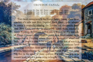
Fleet River and canal pages
Blackfriars / Holbourne Bridge / Hockley in the Hole / Mount Pleasant / Baggnige Wells / King’s Cross / St Pancras Way