Other towpath projects
Hackney’s unique towpath projects

Another type preferred by Hackney – ‘Canal Markers’

Canal Marker with detail giving us the scheme’s origins.
Canal Markers were specific to the Hackney section of the Regents Canal, and despite being labelled as ‘British Waterways’ they were actually comissioned by the LB Hackney with funding from the Dalston City Partnership. At least the Kingsland Road sign still remains (May 2013.)

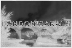
Hackney’s Regent’s Canal towpath descriptive information boards. Almost all have been vandalised. This is Haggerston bridge.

Haggerston bridge west side – yet more vandalised Regent’s Canal info boards!

At least those info boards on either side of Kingsland Road bridge remain relatively clean of graffiti.
 are relatively untouched")
Whitmore Road. One severely vandalised sign but the other two (one each side) are relatively untouched.
Practically all the non-standard signage on East London’s canals erected during the GLC’s Canal Way phase has all now vanished.
Bow Back Rivers – nowdays mostly within the new Queen Elizabeth Park

Unique Bow Back Rivers signage at Carpenters Lock

Sign on south side of Marshgate Lane at start of City Mill River.

Three way post at City Mills Lock, Bow Back Rivers
One somewhat odd sign was that which pointed to Blaker Road (on the Waterworks River.) It was sited on the Greenway and had ‘200’ in huge numerals (denoting the distance in meters) unlike that seen in the picture above where the lettering denoting the Waterworks River is all proportional.
British Waterways had a distinctive style of informatin boards for the Limehouse Cut and Bow Back Rivers with quite detailed maps, as show below.

Old BW information board for the Waterworks River
BW’s ‘blue/yellow’ interpretation signs (static and interactive)
During the millenium years (1999/2000) British Waterways had a comprehensive set of signs installed all the way along the Regent’s Canal. These were identified by their distinctive oval plaques and large information boards, several with winding handles which generated recorded voices relating the canal in bygone days.

The last remaining interpretation board with voice generator on London’s Canals. City Road Islington.

Yellow-blue oval plaque at Lisson Grove tunnel. Note the deteoriated laminated covering.
Just a few legible blue/yellow oval plaques remain. This includes that at the entrance to Maida Hill tunnel, Lisson grove up-side house, Macclesfield bridge and St. Pancras lock. Others have been defaced or their laminated decal destroyed completely.

One of the oval plaques destroyed completely by vandalism. Example at Chalbert St bridge
The blue/yellow scheme was later changed to a deeper yellow, with yellow or burgundy for other parts of the London canals, such as the Hanwell flight. The chequered edging however remained the same.

Above & below: Variations on the colour scheme as seen on the Hanwell flight.

Other towpath projects and their signs on London’s canals

Bow Neighbourhood/Heritage Trail

Bow Heritage Trail on the Hertford Union below top lock. 2003

Bow Heritage Trail at Old Ford Lock
 signage at Old Ford lock")
Capital Ring (and Lea Valley) signage at Old Ford lock.

Wooden signage for the Lea Valley seen at Old Ford junction – seen early 2000.
")
Wooden sign at Old Ford junction (opposite Old Ford locks) Still exists today amazingly!
 plaque, a handful still exist")
Rare Lee Valley (Lee Navigation) plaque, a handful still exist.

Capital Ring signage at Brentford by the A4 bridge

River Brent marker, Trumpers Way bridge, Grand Union.
The section of Grand Union Canal from Hanwell to Brentford had River Brent markers and wooden signposts. These had the legend ‘BRP’ and the wooden finger posts simply indicated ‘Brent River Park.’

Colne Valley Trail along parts of the Grand Union Canal.

Grand Union Canal & Whippendell Walks – Cassiobury Park
 alongside BW 2000's signage. Three Bridges, Norwood")
An old hand-crafted towpath marker (local council?) alongside BW 2000’s signage. Three Bridges, Norwood.
")
Totem-style posts from the City’s streets now being used on towpaths. This is at Baring St (Southgate Road)

Small posts based upon the larger totem style boards on the Lee Navigation